Once Upon A Time, Down A Road Far Far Away…
Motorcycling is a pretty new sport, as far as sports and hobbies go. The very first motorcycle started rolling only a little more than a hundred years back.
Naturally, as with any sport, people set out to stake some flags in the ground for things no one had ever done before, for the glory, the pride, and just for the sake of doing it.
And let’s admit, there’s a decent amount of glory to be had in setting a new motorcycle record, especially a hundred years ago. Those men and women didn’t even wear helmets back then.
In fact, the very first motorcycle record was set not even a decade after the first motorcycle was sold, by a native Californian, George Wyman.
Wyman plotted a course from downtown San Francisco to downtown Manhattan, and in 1903 he set a new world record as the first person to cross North America via any motorized vehicle. His trip was ~3,800 miles across railroads and dirt tracks, and he had to pedal his California Motorcycle Company bike the last 150 miles in New York State. His hands needed bandages by the time he arrived. Total trip time took 51 days.
He beat the first car to make the trip by 20 days.
Not long afterward, Erwin “Cannonball” Baker set a new record, riding his Indian bike from coast to coast in 11 days. This ride would later become a famous ride known as “The Cannonball Run”, which still happens more-or-less annually to this day.
“Cannonball” Baker set 143 driving records between 1910 and 1930, and became the first commissioner of NASCAR.
Over the following decades of the 20th century, motorcyclists would go on to undertake a variety of other record-setting trips, sharing their stories however they could, inspiring future riders to come along and maybe, just maybe, do the same.
Some of the highlights range from the famous rider/journalist, Ted Simon, who circumnavigated the world on his Triumph in the early ’70s, to Dave Barr, a Vietnam veteran who became the first double-amputee to circumnavigate the world via motorcycle (on a Harley, no less).
Imagine that: riding your Harley across the Siberian ice in winter. He even wrote a book about it.
More recently (in our very own 21st century), Ewan McGregor and his buddy Charlie Boorman rode their bikes from London to New York, and documented it as a film series called Long Way Round. They’ve followed up with more in kind after that first series, and at the time of this writing are working on a third season.
In India, Gaurav Siddharth recently set the world record for the longest recorded motorcycle trip in a single country, taking the title from its prior holder, Danell Lynn.
Perhaps the most recent is Henry Crew, who set a new record for the youngest circumnavigation of the globe via motorcycle, and did so on his Ducati Scrambler Desert Sled. (More on Scramblers in a bit.)
Given all of this, one might ask the question, “What’s the next record a crazy motorcyclist is going to set?”
A New Record
There are a lot of records for circumnavigation. Usually this means “of the whole globe”.
And it’s quite a feat – plotting a course across several continents, crossing at least two oceans, and negotiating dozens of border crossings – it’s no wonder it takes months, or even years, to pull it off.
But is it the only thing we have records for circumnavigating?
There are also a lot of records for navigating things like The Southern Cross (in Australia), or for traveling the entirety of the Pan-American Highway. Both are grueling, challenging trips, and riders who’ve done them deserve the records they’ve set. Just completing a ride like these is itself a congratulatory feat of stamina, planning, and luck.
But they’re not circumnavigations, for all else they are.
What about a given continent? Has anyone ever circumnavigated a whole continent, by any means? Or even a single country? What would that even involve?
For clarity, let’s just cover what exactly circumnavigation is. From Merriam-Webster:
circumnavigate. v.
- to go completely around, especially by water
- to go around instead of through
Basically, this means to go “around the outside” of a thing, following the perimeter of whatever is in question (usually the globe) as closely as possible.
And there are a lot of circumnavigations, both of the globe and otherwise. The vast majority of these are via boat, followed by plane. There are a very few by bicycle. Motorcycle circumnavigations, comparatively, are lacking.
Interestingly, while there are a few circumnavigations of a single continent via boat, the same can’t be said for land. And for other circumnavigations, such as a single country or even sub-continent, the same is true: there aren’t any records. Nada. Zilch. Zero. Never been done by motorbike.
We’re not just talking about finishing where you started. Remember our definition? A circumnavigation has to be the outside perimeter. So this would be a route along the roads literally closest to the borders or coasts of a country, or all along the coasts of a continent.
This gives us two possible new records to be set: The First Recorded Circumnavigation of a Country by Motorcycle, and The First Recorded Circumnavigation of a Continent by Motorcycle.
And in a little less than two weeks, I embark with my wife on an expedition to claim the first of those two records.
My partner and wife, also a rider, is embarking on this expedition on her own bike.
The Specifics
Setting a new record means we’ll need to define a few things. No one’s ever done this particular feat before, so to be the first also means that we have to come to terms with the bounds of the record. What counts? What doesn’t?
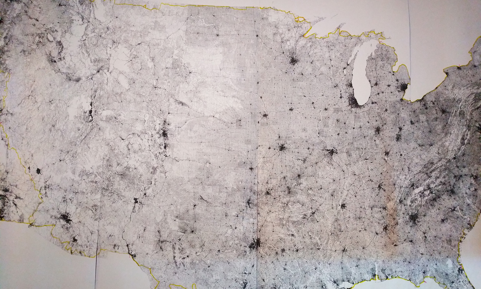
We live in San Francisco, so I’ll be using the Continental USA to set this record, following a route along the literal edges of the country: both coasts, as well as the Northern and Southern borders. The route starts, and ends, at the start of Great Highway (US-1), right at Ocean Beach and Golden Gate Park.
The total distance of the route should be somewhere between 12,857.2 and 15,995.5 miles, depending on factors such as road closures and construction, as well as which roads we end up using. Given an average ride time of ~8 hours a day, we anticipate the time of the trip will take no less than 32 days, and no more than 70, skewing closer to the mid-60-day mark depending on how many miles we can cover each day.
This means we anticipate living on the road for at least two months.
Weather is a significant constraint. This trip can only be achieved during the warmer months in the Northern Hemisphere, as many of the mountain passes are closed from Fall through Spring, as well as many of the roads in New England and the Upper Midwest.
By contrast, late Summer is hurricane season in the Southeast, which is weather that no motorcyclist wants to have to ride through, and which often causes evacuations and road closures due to flooding. Either of these scenarios basically torpedoes the trip, as we’d be unable to access the roads literally closest to the perimeter.
Geopolitical constraints may affect the route as well, given the amount of attention and situation along the US border at this time.
So what are the rules? Which roads count?
Google Maps, while comprehensive and extremely precise, isn’t a very accurate source of truth for mapping data. Often times the roads Google shows aren’t clearly labeled, aren’t passable, are privately owned, or don’t allow any kind of motorized traffic. Google doesn’t always label these as such, as they pull map data from many, many sources, not all of which agree.
In fact, some roads on Google Maps don’t even accurately reflect the actual path of the road in reality – maybe it did at one time, but it hasn’t been updated, or is pulled from an inaccurate data source in the first place. So as detailed as it is, Google Maps can’t be relied upon as a source of truth for US roads.
By contrast, any road atlas you might buy in a store or online isn’t nearly as granularly detailed as Google Maps is. But it is, at least, officially “accurate”.
Data for road atlases is pulled from some of the same government data Google Maps uses, but only lists roads verified as “official” (municipal, state, or federal), as well as listing “other” or “local” roads with varying local conditions which may or may not apply, such as being private property, or even entirely washed out and no longer passable.
However, even the most coarsely detailed road atlas details accurate “official” roads, otherwise the company selling the atlas could be sued for selling a misleading product. This means one important thing.
Road Atlases serve as a good source of truth.
So using a detailed road atlas, like from Rand McNally or AAA, serves as a good way to plot a route around the absolute perimeter of the nation. But there are a few caveats, since not all of the roads that exist on the border count for a record-setting perimeter ride.
And for a circumnavigation to be complete, none of it can be duplicate, meaning none of the roads can be counted twice. A circumnavigation, by definition, is a big loop which ends where it starts.
This rules out spokes, cul-de-sacs, and any other road which requires revisiting a stretch that’s already covered. No repeats.
Similarly, many of the roads at the perimeter or coast of any given city change often, due to environmental needs, or shipping needs for a port. (This is true of roads within a city generally.) Many of these roads also require special permits to use, and many more aren’t even available for public access, being restricted to various governmental bodies for military purposes. Given that the purpose of the record isn’t to negotiate traveling along off-limits access roads, we can address these scenarios by how we track what counts for the record within a city.
A circumnavigation via land must enter any municipality along the route at the outermost public road, and also exit by the outermost public road. How you get through the twisting, labyrinthine streets of a city doesn’t matter, so long as you don’t leave the municipality except by the route which counts. (The outer one.)
Also, since the spirit of setting a record is for someone to later come and beat that record, there’s an additional clause we’ve added:
Neighborhood roads through subdivisions, by and large, do not count.
This record isn’t about driving past people’s driveways and staring into windows and homes. It’s about setting (and ideally beating) a record, not invading people’s privacy.
The Cast
So who’s all involved in this derring-do, somesuch and whatnot?
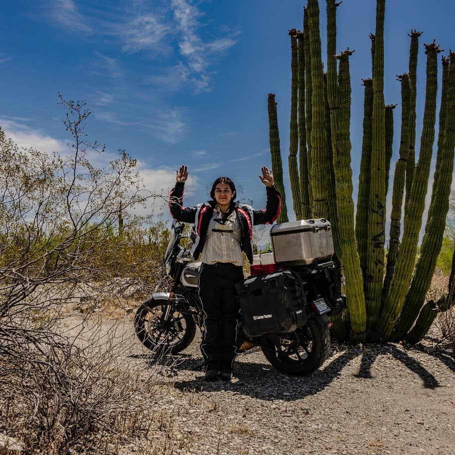
Well, myself of course. Also my partner in expeditions great and small, Jackie.

You can find us on the social medias by way of @strictlyskyler and @jyquinn.
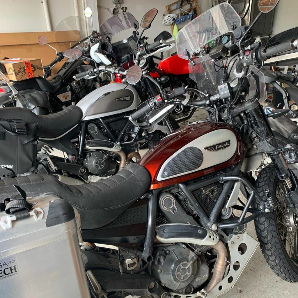
As for our steeds, we’ve settled on some fairly custom, totally kitted out Ducati Scramblers:

I could go on and on about how great I think these bikes are. Maybe I will soon. Probably will on the road. Very likely.
In a nutshell, these bikes are light, easy to ride, and easy to turn into what works for you. In our case, a totally rad pair of light adventure bikes, dialed in for shorter riders. Hashtag ADV, y’all.
We also have a variety of friends and family spread all across the country, with whom we’ll be linking up as we roll. Some of ’em are even gonna ride with us for part of the trip! (Yay!) Wanna tag along for part of the ride? Hit us up!
Tracking Progress
Of course, you’ll be able to follow along with us here. And you can see pics of what we encounter on Instagram. But to really set the record, we’ll need proof. Coordinates. Irrefutable evidence that we did this feat, and aren’t making it up.
We’re taking a variety of GPS devices with us to record progress. Our location gets updated roughly every 5 minutes, and you can follow along in near real time by visiting https://where.skyler.is to see our last recorded location.
Beating The Record
So there you have it. Go and find a road atlas, and get planning. Think you can plot a course to beat ours? You’d need to either go the same route in fewer days, or plot a route closer to the perimeter for longer distance.
Or, for another country than the USA, you’d need to plot a longer circumnavigation than this one.
Good luck out there. Keep your sunny side up, and your rubber side down!
